Based on this project, Project 04,
1. Students in groups need to obtain information for development and carrying out preliminary studies for a housing development that will be planned at Lot 12733 (P.T. 1949, 1950 and 1951), Kg. Tok Suboh, Distrinct 14, Bukit Minyak, Seberang Perai Tengah, Penang. Students are required to produce the Proposal of Development Report or in Malay, Laporan Cadangan Pemajuan (LCP) excluding the Proposed Layout Plan.
2. Analysis of the study should take into account the impact of economic factors, environment and local communities. The students are required to obtain site information including environmental aspects such as location, contour, the direction of prevailing winds, the sun, the potential and etc..
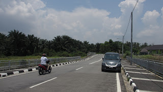
3. Students must produce a report of A4 size. Report shall contain the Key Plan, Location Plan and Site Plan and related data that can provide complete information on the site. The report should include sketches of site environment other than the picture site.
Here, we had doing an analysis of the site.
After analysis the site that will built, our group had discuss to find rule and act. Rule and act are important what the land use in needs. We also discuss and divide in every task.
After three weeks including mid semester break, we had done our part to complete LCP. So, what content need of LCP?
Here,
Following this guide, this is helpful for us to do for LCP,
http://www.mpsp.gov.my/dasarmpsp/Garispanduan/01Lcp/GP1_51Jadual1.htm
Section 21A (1) In addition to the documents and plans required to be served under section 21 (1) for planning permission the applicant shall serve a development proposal report which shall include: -
PROVISIONS
ACT |
DESCRIPTION OF TABLE
OF CONTENTS |
DESCRIPTION
|
(A) concepts and
justified the development  |
|
This information is useful for the local planning authority (local planning authority) in making the right considerations on the proposals submitted. It is also advantageous for the applicant to determine the proposals, appropriate to overcome obstacles to make their projects viable
|
(B) a location map and
site plan |
|
To show the actual position of the site to be developed, and its present condition and the surrounding development, including existing facilities.
|
(C) details of the ownership
of land and restrictions on land |
| To show proof of ownership and exact location of sites and land-related information is material to the application for planning permission.  |
d) (i)
description of the land, including the physical environment topografinya, landscape, geological, konturnya, salirannya, water catchment and natural forms on it which is likely to touch by the development.
| Studies report on: -
|
Inform about the state of existing land to be developed, including the appearance of the earth, no vegetation, drainage and all that is on it.
 |
| (D) (ii) the results of the survey the trees and all kinds of plants that plant is likely to be touched by development. |
|
Seeks to inform all the trees and the existing plants and to assess the extent to which this development will affect the flora and fauna of the area.
 |
(D) (iii) details of the
building that is likely to be touched by the developer  |
|
Intended to make an assessment of the buildings including the position of existing and it is likely to have the characteristics of architectural and historical interest to be maintained.
|
(E) analysis of land use
and its impact on land adjoining  |
An analysis of land use in accordance with the following aspects: -
|
Aims to assess the extent to which the suitability of the proposed development with existing development in the vicinity of the proposed site.
|
 |
| |
|  | |
(F) plans
layout that contains the particulars specified in Section 21B |
See Table II.
(PROJECT 05)
|
Intended to show in detail how this development will affect the physical characteristics of the area.
|
(G) such other matters
as may be prescribed by the Authority Planning and Local.  |
The local planning authority may request the applicant to provide any documents or items related to the development proposal for making the judgment in the planning approval process.
Examples are additional details of an existing building that has historical value or architectural interest, or additional suggestions about the work of the land to be done to ensure minimum damage to its original natural topography of the area to be developed.
|
The local planning authority may request any other matter that can be used to make judgments in the processing of applications for planning permission.
|


No comments:
Post a Comment